Professional drone services for agriculture, real estate, and infrastructure. Veteran-owned and operated in Cochise County.
Comprehensive aerial intelligence solutions tailored to your industry and objectives.
Stunning aerial photography and cinematic video that sells properties. High-resolution stills and up to 6K video for residential, commercial, and vacant land listings.
Learn MoreRGB vegetation health mapping, crop stress detection, and precision scouting for vineyards, orchards, and farmland. Data-driven insights that optimize yield and reduce waste.
Learn MoreDetailed terrain models, elevation data, and contour maps for construction planning, land development, and property assessment. Survey-grade accuracy.
Learn MorePhoto-realistic 3D models of structures, terrain, and sites. Interactive fly-throughs for construction, real estate marketing, and historical documentation.
Learn MoreRoof inspections, storm damage documentation, property condition reports, and insurance claim support. Safer, faster, and more thorough than manual inspection.
Learn MoreScheduled aerial documentation of construction sites. Track progress, verify milestones, and create compelling timelapse deliverables for stakeholders.
Learn MoreWhat sets us apart from the rest.
Every flight delivers actionable intelligence, not just pretty pictures. We provide the data that drives decisions.
Based in the Sulphur Springs Valley, we know Cochise County terrain, weather patterns, and the unique needs of Southern Arizona operations.
Military precision applied to every mission. On time, on target, every time. FAA Part 107 certified.
Experienced across diverse sectors in Southern Arizona.
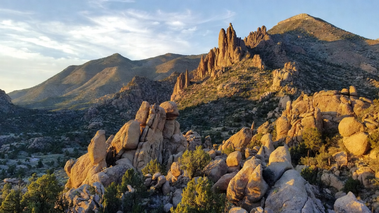
Stronghold Precision Aerials takes its name from the Cochise Stronghold — the legendary fortress in the Dragoon Mountains where Apache Chief Cochise made his stand, choosing terrain that gave him the ultimate strategic advantage.
We bring that same philosophy to aerial operations. From the Sulphur Springs Valley, we provide precision drone services to agriculture, real estate, and industry across Southern Arizona. As a veteran-owned company under Stormhaven Enterprises LLC, we apply military discipline and attention to detail to every mission.
Our clients don't just get aerial footage — they get actionable intelligence that drives better decisions. Every flight is executed with precision, every deliverable is professional, and every project receives the focus and rigor it deserves.

Cochise County, Arizona
Sulphur Springs Valley
Professional drone services across Cochise County and Southern Arizona
Request a free consultation and quote for your next project.
Expert insights on NDVI scanning for agriculture, aerial photography for real estate, and precision drone services in Southern Arizona.
Discover how NDVI scanning helps viticulturists in the Willcox AVA detect water stress, optimize irrigation, and maximize yields.
Why aerial drone photography is becoming essential for real estate marketing and how it helps properties sell faster at premium prices.